Reference Map of South America
Summary:
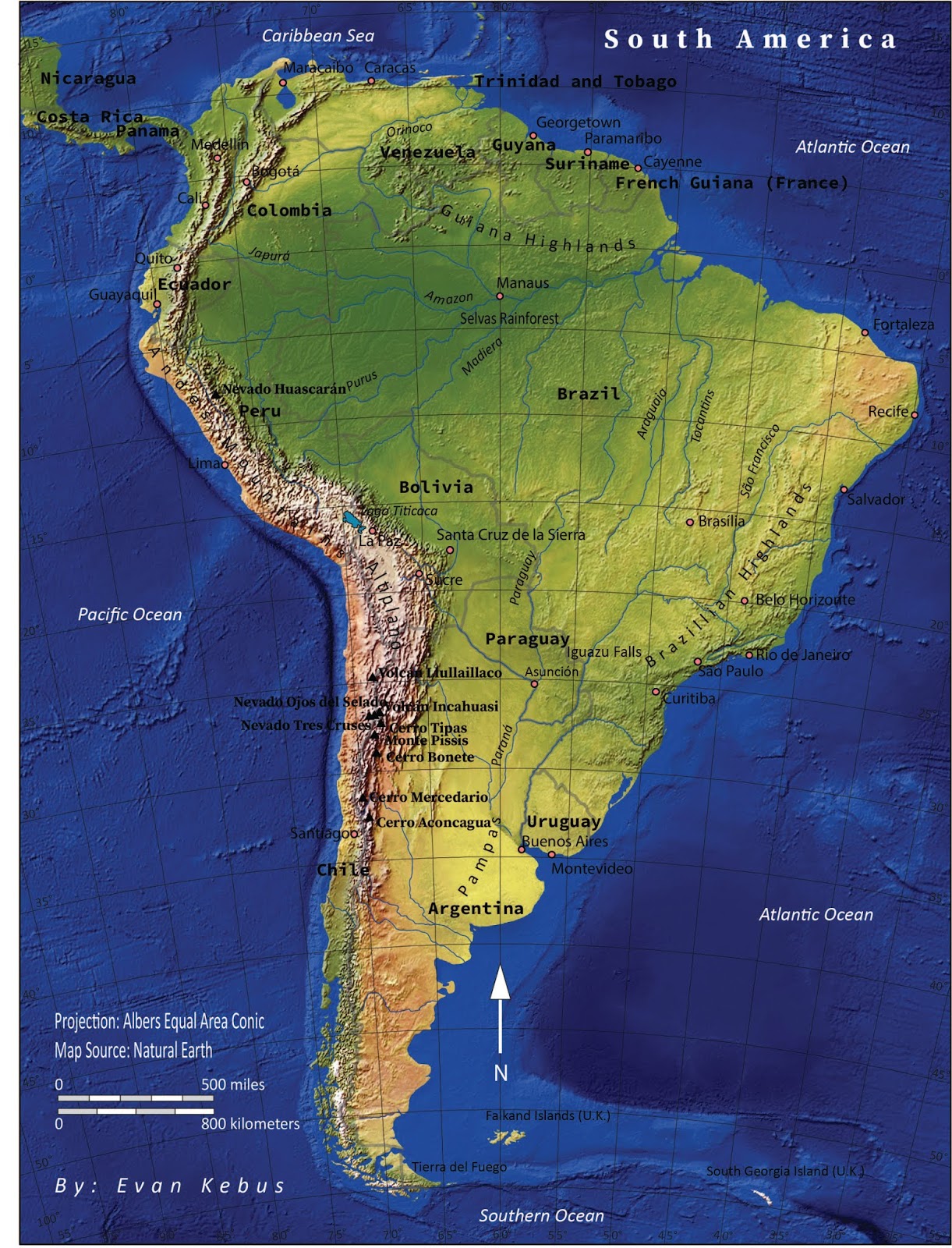
This is a reference map of South America that I created which includes countries, specific cities, rivers, mountain ranges, volcanoes, mountains and the oceans. I was tasked with including all these features and to create an aesthetically pleasing and accurate map of South America while doing so. The purpose of this assignment was to increase my familiarity with Adobe Illustrator CC as well as applying the five essentials of map design (legibility, figure-ground, clarity, visual hierarchy and balance). I was also tasked with including elements of map design such as title, legend, scale, data information, graticule, neat line, labels and other key elements. The entirety of this map was created in Adobe Illustrator CC and through this process I learned how to organize and work with layers while adjusting properties of the map. Learning how to lock, unlock and select elements of the map to edit is an essential function of this program. I was able to edit font sizes and typefaces as well as changing the opacity of images and move certain elements around in the layers section to highlight more important features of this map. If I was to make further edits to improve this map I would add halos to some of the black text to make it more readable against the blue ocean background and brown areas of the Andes Mountain range. I would also be inclined to include more cities and label more of the rivers near the southern tip of South America. I would also include callouts for major rain forests since that is a major interest to me as an Environmental Geographer.


Comments
Post a Comment